


 Monday, Sept. 26th. We awoke to another sunny morning. We went into town to pick up our mail that Jamie had sent to us care of General Delivery in Bar Harbor. We then walked around town. What a difference from the weekend crowds. We came across an old cemetery from when Bar Harbor used to be called 'Eden'. Coincidentally, there were many 'Roberts' in the cemetery and there were graves dating back to the early 1800's. Also, a monument to fallen sons of Maine who perished in the Civil War.


 Sunday, September 25th. We woke up to a beautiful, sunny morning that seemed more like summer than fall. We went to the National Park to see the sights. There's a 30 mile drive to see all the beautiful vistas. It was very crowded as if this was the last summer weekend. But it was well worth the congestion. There were many places to see vistas of the Maine coastline. We also drove to the top of Cadillac Mountain, which gives the best views of all. We finished the day having our first 'lobster rolls'. This is bread that's kind of like a hot dog bun. It is stuffed with lots of lobster meat and comes with cole slaw and chips. It was very good.

 Saturday, September 24th. We left at about 10:30 for our 4 hour drive. We drove through rain and a heavy overcast. After we got set up at our new campground we drove into Bar Harbor. Although not raining, it was still heavily overcast. As we came over the hill into town, we could see the tops of the numerous islands off the coast. There was also a cruise ship in the harbor as this is a popular cruise destination for seeing fall colors. The town is neat, but very touristy. I'm sure the residents here are looking forward to getting their town back after tourist season. We saw one truck that had a bumper sticker that said..."if it's tourist season, why can't we shoot them?"
 |
| lobster at last |
 |
| The Balsams Resort |
 |
| a little country lane |
 |
| 18th Fairway |
 |
| Screw Auger Falls |

 |
| stone house |


 |
| on the back platform |
 |
| view from Mt. Washington |
 |
| at the summit |
 After we got set up in the campground, the owner advised us to visit Mt. Washington that afternoon. This is because clear skies are not normal for up there and it was predicted to be cloudy and rainy the next 2 days. There's a self guided CD tour up the mountain, pointing out vistas, flora and telling the story of the mountain road. Mt. Washington is the highest peak in New England. Travel to the top began in the 1700's and the first official roadway was opened in 1861. It's an 8 mile drive to the top, where the elevation is 6288 ft. There are no guardrails and the sides are often sheer drops. Diane missed some of the ride because she had her eyes closed. A rustic hotel was established in the late 1800's and a weather station was established in the early 1900's. In 1934 the meterologists stationed at the peak recorded wind speeds of 231 mph, the highest ever recorded anywhere. The views are spectacular and it was a nice welcome to NH and an end to our day.
  |
| The Gorge |
 Tuesday, Sept. 20th. We woke up to a rainy, overcast morning. We had breakfast at the train depot in Randolph (a train came thru while we were eating). A train conductor was there as well having breakfast. He explained that while freight trains could go thru, passenger train passengers had to go by bus thru this area because of the flood damage along the passenger route.
  |
| bridge survives; approach destroyed |
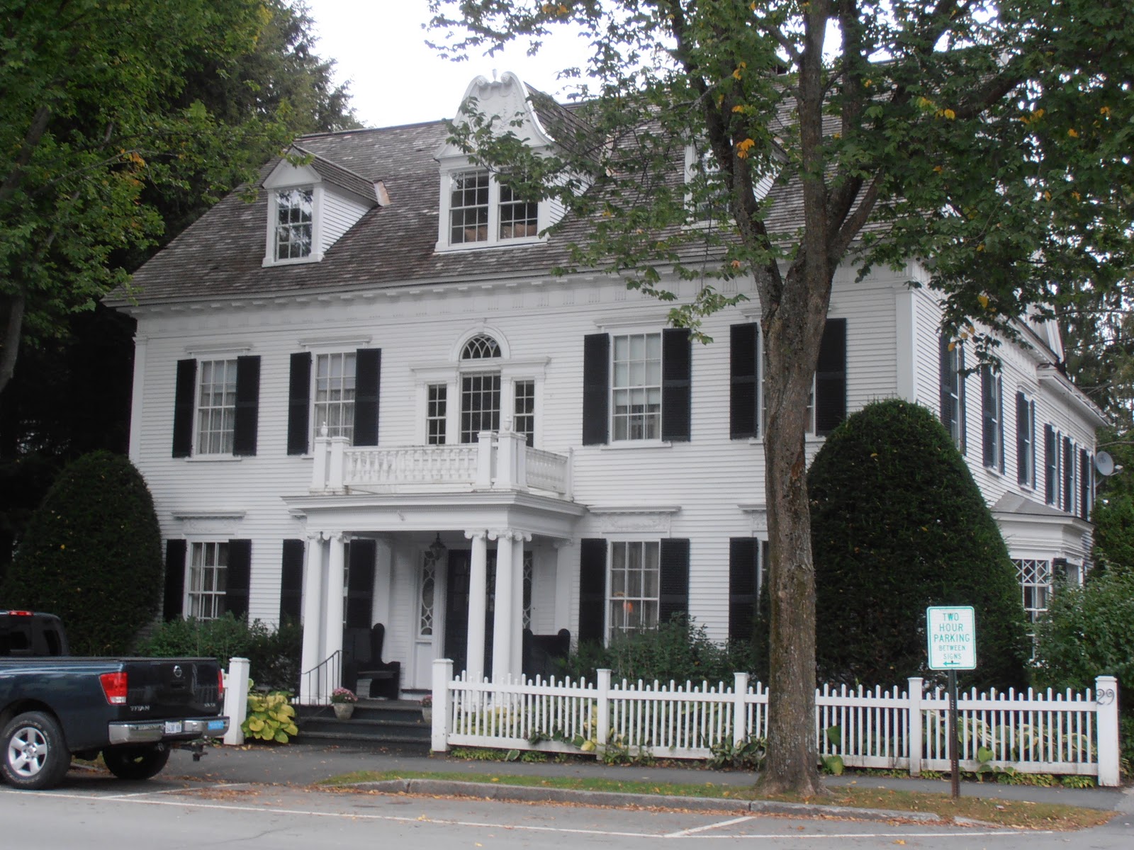 |
| 'typical' Woodstock heritage home |
 Monday, Sept. 19th. In the morning we drove about 90 miles down the road to Randolph Center. The campground is called Lake Champagne. It's a beautiful setting... probably an old farm turned campground 20 years ago. We think it's the most beautiful campground we've been to so far. After we got set up, we went south to visit the titled cities. When thinking of Vermont, Diane had a couple of preconceived ideas. Beautiful fall colors on the hillsides and quaint town squares in the center of the downtowns. Well the leaves are just beginning to show signs of coloring. Some of the towns did have squares. OthP9190015.JPGers were a wide spot in the road and you wondered what happened to them.
 This is the area of the White River and is where so much flood damage occurred. All of these towns had FEMA centers to help displaced/impacted citizens. Very sad and sobering to see the impact on peoples lives in just a few hours. Folks told us that the worst flood had been in 1927...until this. More folks were killed in that one due to improved forecasting abilities today. But there was far greater and more widespread property damage from Irene.
  |
| flavor graveyard |
 Sunday, Sept. 18th. Sure enough, Sunday morning was a beauty. Diane had a great day planned for us. Our first stop was Ben & Jerry's factory in Waterbury. It was a very informative tour with free samples at the end. They are constantly trying new flavors so they have a graveyard for flavors that have gone by the wayside. The Cookie Dough flavor has been and still is #1. However, my favorite is Cherry Garcia.
 From there, we drove about 5 miles to Stowe. It is a beautiful, old town that has been taken over by the wealthy ski crowd. The immediate downtown is quaint and hearkens back to time gone by. But outside of that it's all condo's and pubs and restaurants catering to the ski crowd. The ski facility is called Smuggler's Notch. It's a beautiful drive up to it. The mountain is surprisingly rugged (by west coast standards) and a popular destination even during non-ski season.
 |
| flood level 8' above the road |


 |
| Lake Placid and lakes beyond |
 |
| Ice on trees and a castle at summit |
 |
| ski jump towers--12 stories |

 |
| John Brown's tombstone |
 |
| Add caption |
 |
| Di soakin up some rays |
 |
| Ocean freighter bigger than islands |
 |
| classic wooden boat |
 |
| Turn of century home in Clayton |

 |
| Sackett Harbor |

